Geodesign for everyone: A case study in Brazil
May 12, 2017 — Blog
Vote for me! Vote for me! Vote for me!
How often do you get to actively participate in planning and design process? Reviewing complicated planning documents can be hard, since attending public planning meetings often means clearing your schedule and going out of your way to attend. Geodesign is an emerging field that’s opening up this process to broad public participation via online voting. Just last month, a recent pilot project in Minas Gerais, Brazil demonstrates the state of the art in pushing geodesign towards digital democracy and public participation.
Designing for consensus
Geodesign is a collaborative design activity where scientists, architects, engineers, planners, and regular people come together to plan for their collective future. Geodesign provides a systematic way to build master plans, develop climate change and resilience strategy, manage cultural and environmental assets and engage citizens. It enables different stakeholders to work together in a process where the impacts of proposed designs are shown in real time. What makes geodesign interesting and innovative is that the process is geared towards negotiations between different stakeholders striking a compromise. It shifts the existing paradigm from a zero-sum game to a win-win situation.
Geodesign provides a strategy to help build consensus among different stakeholders. However, it is still fragile when it comes to genuine democratic participation regarding land use. The decision-making process in a representative democracy is a delicate subject as a representative must often make decisions on behalf of hundreds, thousands or even millions of people. It is important to provide elected officials with data about the community’s desire to support their decision. This data must be collected fast and processed quickly. The geodesign process and technologies we tested in this study assist urban planners and decisionmakers in the important task of gauging citizen’s opinion on their ideas for change.
New tools for Participatory Planning
In April 2017, we conducted a geodesign workshop at the Universidade Federal de Minas Gerais entitled “Alternative Futures for Serra da Calçada and Serra da Moeda”. We used Geodesignhub, a platform for collaborative planning and geodesign.
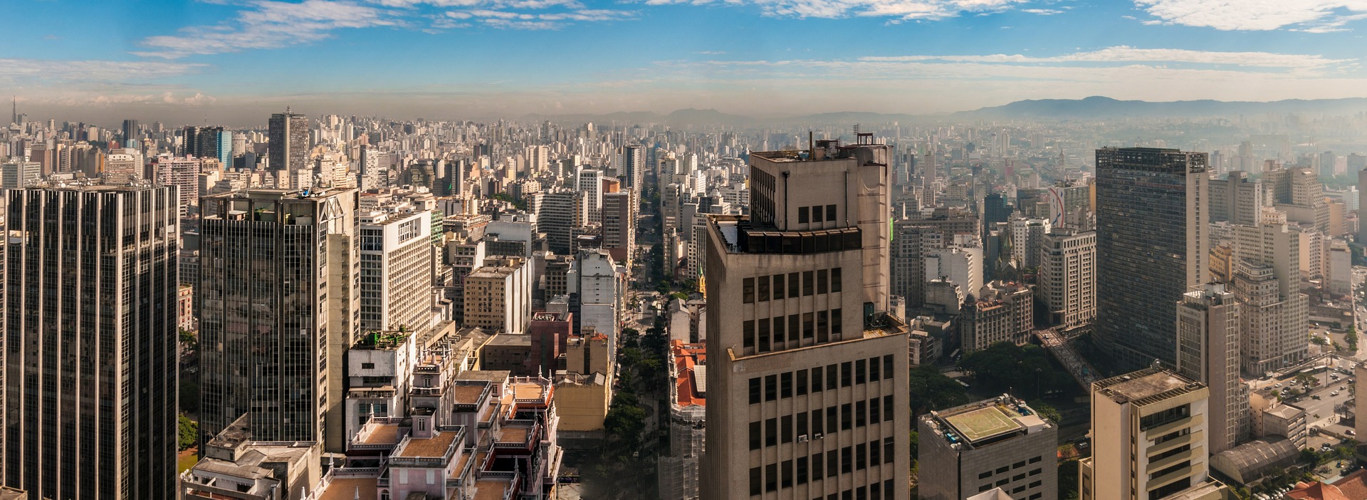
The study area can be described as the intersection of diverse municipalities near Belo Horizonte city, the capital of Minas Gerais State. The place has developed rapidly, mainly because of the presence of the iron mining industry. Importantly, the area is a crucial aquifer recharge area that guarantees access to water, not just for those who live there, but for many in the neighbouring Belo Horizonte as well.
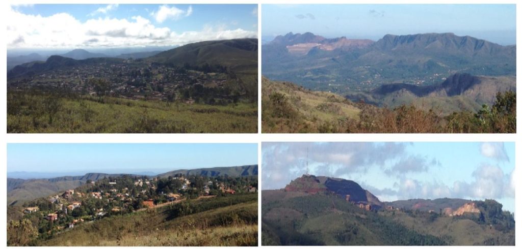
From a planning point of view, this workshop explored the main issue faced by the citizens in this area: they are far from the core developed municipalities around Belo Horizonte and lack urban development planning and infrastructure. One demonstration of this problem: there is a neighbourhood that belongs to one municipality but its access road belongs to another. Boundary issues of this kind also happen with school districts, health care coverage and other public services – a complex, yet not too uncommon issue facing many rapidly urbanizing regions around the world.
The workshop participants were asked to think about their future by considering the question: “How might the study area be altered?” The technology provided a way to examine the impacts of proposed changes and helped to answer the question “What differences might the changes cause?” This sort of real-time impact analysis forces people to negotiate, rethink ideas and develop more nuanced perspectives.
Continuing engagement beyond public meetings
During the workshop, we formed five stakeholder groups – public administration, culture, ecologists, investors and local community – to build the initial designs. From these initial designs, we selected 37 proposals to be shared with the general public for a vote. A proposal is a diagram, and if a diagram was selected by four or five teams, it was added to the public vote.
Sharing the design
Blog posts have proven to be an effective and accessible method to explain the process and outcomes, while also sharing a voting link to make thier voice heard again. Using whatsapp, a Facebook page, and the local NGO Instituto Cresce’s Instagram account (@institutocresce), we shared this link with several stakeholders, some attending the workshop and some not – asking them to vote and share it further.
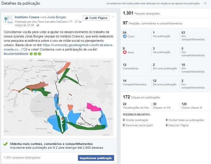
The day-long workshop had 25 co-designing participants. These were a mix of professionals representing environment, public administration, local community, investors, culture and tourism from the area. The population directly affected by the workshop is 27,704 according to the Brazilian Census (2010). Since it is the first time we were doing this project, we limited our advertising and outreach. The figure below shows data from a post on the Facebook page: 1,301 people reached (almost three times the number of people who like the page); with 97 reactions, comments or shares. No negative feedback was registered.
Understanding the impacts and potential of Geodesign
In just one week of voting, the projects received more than 3,000 votes. This is a tremendous example of technology’s ability to engage wider participation, and shows enthusiasm and an appetite for this process on behalf of citizens. Voters took an average of four minutes to review the set of proposals, and approximately nine seconds to register each vote.
Users reaction to the process was generally positive, with comments including: “easy sharing of consensus proposals made broad participation possible”, “this is the future of democracy”, “I hope this is actually used some day by governments”. However, we were especially interested in the negative feedback, to develop and improve the participation strategy and tool. Reflecting the jaded, or disillusioned attitudes often prevalent as a result of current public outreach, some people had questions and comments such as: “Do I have to think to answer this?” “Do I have to read all this?” and “Too many proposals at once”. While this indicates a lack of patience in terms of citizen participation, it is also vital information to help better shape these tools and processes to reach the hard-to-reach. Further feedback suggested a lack of information about proposals and a lack of development or nuance in the diagrams themselves. One important lesson from this process is that the use of video, in addition to text, is a stronger strategy, as is the case with most popular crowdsourcing platforms such as Kickstarter or Indiegogo.
Smartphones were mainly used for voting and, given the short time per vote (~ 9 seconds), we can conclude that voting can be similar to “liking” on Facebook. Using the smartphone to vote on planning proposals is a powerful method of public participation. A large population now has a smartphone so using it as a distribution mechanism makes planning data available to a broad group of people. However, when dealing with the smartphone, one has to be cognizant of the context in which it is used. A number of people use them “on-the-go” and people interacting with it have short, speedy responses (tapping something, checking yes or no, etc.). The voting app is designed and optimized for this paradigm of quick response. Given the speed with which people voted, the primary risk is that people don’t appreciate the nuances of a proposal, its interconnectivity with other proposals and that the details are lost. In some ways people are reacting with their “gut” after reading text and looking at a diagram on a map. However, our results show very high level of engagement with planning information.
Geodesign and the future of participatory planning
Much has been written about public participation and urban planning -a major field of academic research. In this pilot project, geodesign technologies shines light on new ways to engage a broad set of people and make their voices heard in an objective fashion. We have no doubt that visual modeling and spatial technologies will be at the center of tomorrow’s tools for capturing local sentiment about designs as they are made – truly co-designing and shaping plans that matter most to communities. With the help of technology and these tools, we are building the basic analytical building blocks for large scale pattern matching and crowdsourcing.
Geodesign uncovers a formula that enables bottom-up planning contributions to be made in a seamless way with a high level of engagement – this is exciting, given the prevalence of social media in most countries. There are many open and unanswered questions, such as: would refining the interface increase engagement? How much information should be displayed? Should comments be allowed? etc. Some of these questions need more experimentation, and some more data. We are just beginning to scratch the surface of geodesign technologies for everyone, and we intend to carry out more studies like this in the future.