Next Optimized Generation Autonomous Suburbs
August 19, 2022 — Expertise
Virtual Learning Series | In partnership with the Toyota Mobility Foundation
Next Optimized Generation Autonomous Suburbs
Today, suburban areas are home to an ever-increasing majority of the global population. Trends indicate that growth within greater metropolitan areas now outpaces that in urban cores and will continue to do so into the future. As areas of suburban density become the dominant living condition for most North Americans, the challenges associated with their lower-density, car-centric development pattern prove more problematic.
Thankfully, we are at the cusp of an innovative era of research, planning theory, and design tools that will shape the next generation of suburban development. In this three part series, we explore novel landscape configurations that reimagine the suburban built environment guided by advances in autonomous transportation technology, micro mobility, and on-demand services.
Optimizing Suburbs of the Future for Autonomous Mobility: Modeling Master Plans and Suburban Blocks
The Next Optimized Generation of Autonomous Suburbs (NOGAS) is a scenario-based parametric modeling tool designed for spatial planners, urban designers, land developers, and municipalities to integrate emerging mobility technologies into new urban forms, and plan and build for the future.
In part three, watch as Professor Alan Berger explains the novelty and structure of NOGAS, and how it is used to model for future development patterns in the autonomous era.
“The emergence of autonomous transportation technology and the proliferation of mobility on-demand services are going to offer innovations in sustainability for all the urban fabric that’s going to be built” – Alan M. Berger
In this video, we take a look at two use cases, one at the local government level, and the second from the perspective of a neighborhood developer to learn how the tool has specifically added value to each of them.
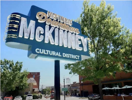
The McKinney City Case
Presented by Kim Flom
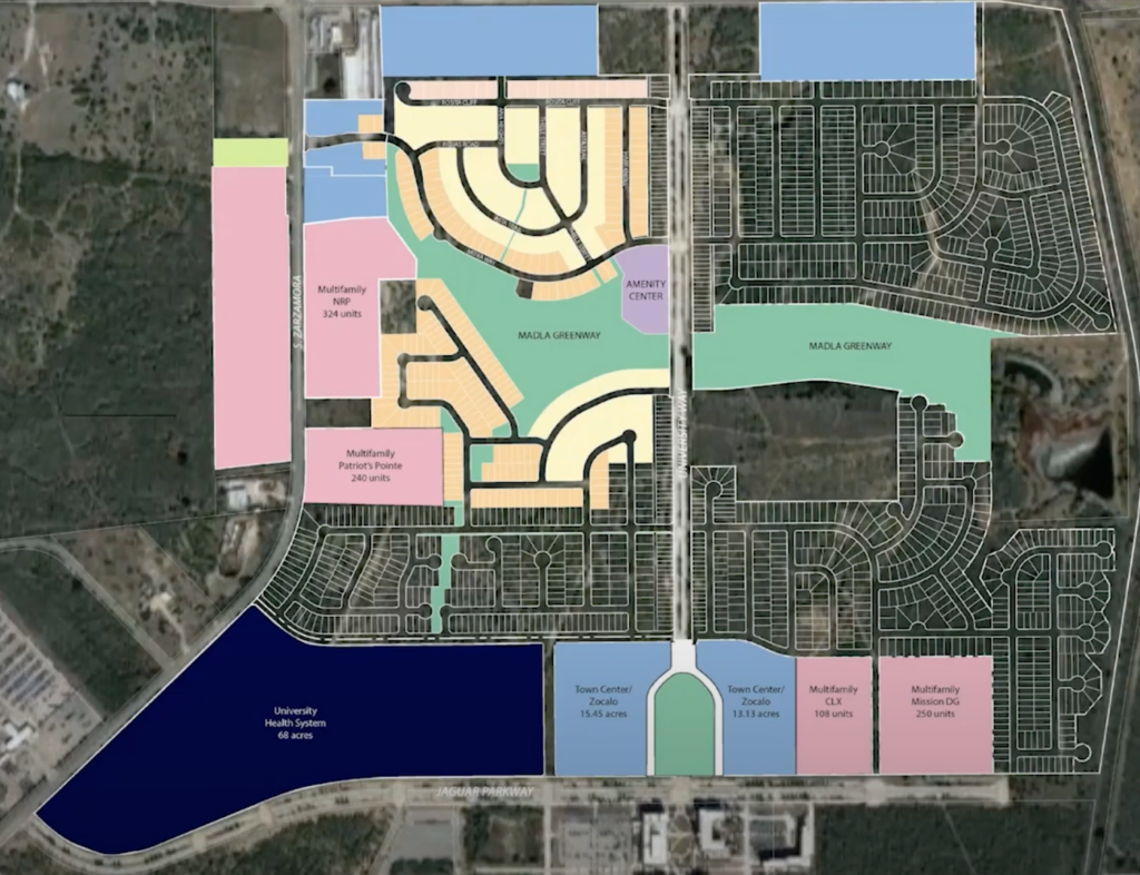
SouthStar Communities
Presented by Thad Rutherford
What makes NOGAS unique?
- The tool allows users to optimize future design for less pavement redundancies, more landscape space, increased shade, and other environmental and social benefits while maintaining or increasing density.
- The software optimizes for proximity, breaking down large single-use land areas into much smaller land use clusters with increased walkability and connectivity between residential area, green space, and commercial land.
- Models provide urban planners and city agencies a new way to evaluate and objectively measure the benefits of design trade-offs as development patterns evolve.
- It allows you to visualize how different components of the development model can be integrated into land-use planning and regulations over time.
The Suburbs of the Future: Optimized for People and the Environment
In part two, delve deeper into the suburban condition and the future of new urban forms that blend the urban and suburban. Trends towards more decentralized forms of living present new opportunities for master planned design that integrate emerging mobility solutions. Learn how leading researchers are optimizing the suburban block while addressing pressing environmental and sustainability issues.
TAKEAWAYS
- With suburbs occupying the majority of land area in US metropolitan regions, they are slated for continued population growth. There is a huge opportunity before us for suburban retrofits to transform environmental conditions and improve quality of life.
- The risks of not investing in suburban transformation far outweighs the cost. Continuing car-based urbanism patterns will have devastating effects on people and the environment that we cannot ignore – implementing alternatives is imperative.
- As the suburbs and exurbs grow, we will see continued blending of urban and suburban forms to create polycentric and human-centered regions with more diversified mobility options.
- New modeling tools and innovative research will soon allow planners to design infrastructure that weaves together existing and new mobility modes, optimizing for people and sustainability, not just cars.

Connecting Suburbia: A conversation between Joel Kotkin and June Williamson
Who really lives in the suburbs and why are they significant today? Part one of the series explores the dominant suburban model and how the history of car-based urbanism has led to social, environmental, and economic challenges.
About the NOGAS Modeling Tool
NOGAS uses a unique scenario-based modeling workflow to generate optimized suburban land use patterns, mobility frameworks, and urban design for a future when autonomous mobility options are ubiquitous.
The software tools invented as part of NOGAS can be used by cities, planners, developers, and designers to test for increased environmental performance benefits using more than 20 distinct parameters.
NOGAS is a research project of the MIT Norman B. Leventhal Center for Advanced Urbanism and P-REXlab at MIT in collaboration with Toyota Mobility Foundation.